Stretching across the Penang Strait between Penang Island and mainland Penang, the Penang Bridge is one of the most recognisable landmarks in the state and an essential part of Penang’s transport network.
Officially opened to traffic in 1985, the 13.5-kilometre bridge connects Perai on Seberang Perai with the eastern side of Penang Island. It was Penang Island’s first road connection with mainland Peninsular Malaysia and remained its only road link until the Second Penang Bridge opened in 2014.
For visitors arriving in Penang by car from Kuala Lumpur, Ipoh or elsewhere in Peninsular Malaysia, there is a good chance that your first glimpse of Penang Island will come while crossing this bridge.
This guide covers everything you need to know about the Penang Bridge, including its history, route, tolls, driving experience, traffic conditions and the difference between Penang’s two bridges.
Penang Bridge at a Glance
Here are some of the essential facts about the bridge:
- Official name: Penang Bridge / Jambatan Pulau Pinang
- Length: 13.5 kilometres
- Opened: 1985
- Connects: Perai on the mainland with Penang Island
- Road configuration: Dual carriageway
- Operator: PLUS Malaysia
- Function: Road connection between Penang Island and Seberang Perai
The bridge originally operated as a dual two-lane crossing before being widened to six lanes in 2009 to accommodate increasing traffic.
Where Is the Penang Bridge?
The Penang Bridge crosses the Penang Strait between Perai in Seberang Perai and the eastern side of Penang Island near Gelugor.
On the mainland, the bridge connects conveniently with the North-South Expressway network, making it an important gateway for motorists travelling to Penang from Kuala Lumpur, Ipoh, Kedah and other parts of Peninsular Malaysia.
After crossing onto Penang Island, motorists can continue north towards George Town or south towards Bayan Lepas and Penang International Airport.
For travellers heading towards central George Town, the first Penang Bridge is generally the more direct of Penang’s two bridge crossings.
A Brief History of the Penang Bridge
Before the Penang Bridge existed, travelling between Penang Island and the mainland relied heavily on ferry services.
As Penang developed and vehicle ownership increased, the need for a permanent road connection between the island and mainland became increasingly important.
The Penang Bridge eventually opened to the public in 1985, transforming connectivity between the two halves of Penang. PLUS describes it as the first road connection between Penang Island and Peninsular Malaysia.
Its significance extended beyond making journeys more convenient. The bridge strengthened the physical connection between Penang Island and Seberang Perai, supporting the movement of residents, workers, businesses and goods across the state.
For almost three decades, it remained the only road bridge connecting Penang Island with the mainland.
That changed in 2014 when the Sultan Abdul Halim Muadzam Shah Bridge, commonly called the Second Penang Bridge, opened farther south.
How Long Is the Penang Bridge?
The Penang Bridge is approximately 13.5 kilometres long.
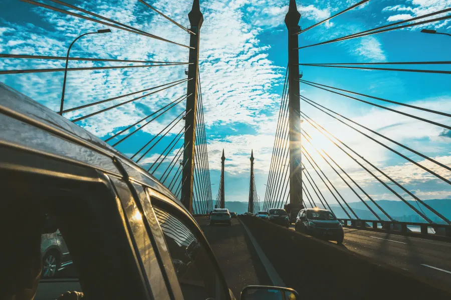
Its distinctive elevated central section has become one of the most recognisable features of Penang’s skyline. Drivers crossing the bridge get open views across the Penang Strait, particularly around its higher central spans.
Although today’s journey across the bridge may feel routine to Penang residents, its scale made it one of Malaysia’s major infrastructure achievements when it opened in the 1980s.
Driving Across the Penang Bridge
For most visitors, driving across the Penang Bridge is straightforward.
The bridge forms part of a major road connection, and directional signs on both Penang Island and the mainland make it relatively easy to access.
The crossing also offers some impressive views of the Penang Strait, mainland Penang and Penang Island, although drivers should naturally keep their attention on the road.
PLUS states that the bridge is equipped with safety infrastructure including traffic CCTV, Variable Message Signs and emergency facilities.
If you are unfamiliar with local road conditions, read our complete Driving in Penang guide before renting a car or beginning a road trip around the island.
Penang Bridge Toll
The Penang Bridge is a toll bridge, with its toll plaza located on the mainland side before entering the bridge towards Penang Island. PLUS lists Jambatan Pulau Pinang Toll Plaza among the toll facilities under its network.
Motorists should check the latest toll rate before travelling, as charges can change and differ according to vehicle classification.
Penang Bridge uses its own vehicle classification system covering motorcycles, passenger cars, taxis, buses and different categories of commercial vehicles.
How Do You Pay the Penang Bridge Toll?
Malaysia’s expressways increasingly use electronic and cashless payment systems.
PLUS advises motorists using its network to ensure sufficient balance in their Touch ‘n Go card or eWallet before travelling. RFID is also available at toll plazas equipped with dedicated RFID lanes. PLUS currently identifies the Penang Bridge as one of the locations involved in its open-payment implementation.
Because accepted payment methods and lanes can change, check the latest PLUS information before your journey rather than relying on cash as your default payment method.
Is There a Toll When Leaving Penang Island?
The Penang Bridge’s toll arrangement is directional rather than requiring drivers to stop and pay at both ends of every crossing.
If you are planning multiple crossings between Penang Island and Seberang Perai during your visit, check the current toll arrangement and rates through PLUS before travelling.
This is particularly useful when deciding whether to stay on Penang Island or mainland Penang during a road trip.
Penang Bridge Traffic
The Penang Bridge is an important commuter route as well as a major interstate connection, which means traffic can become heavy at certain times.
Congestion is most likely during:
- Weekday morning rush hours
- Late afternoon and evening commuting periods
- Friday evenings
- Long weekends
- School holidays
- Major festive periods
- Accidents or vehicle breakdowns
Traffic can also build up on the approaches to the bridge rather than on the main span itself.
If you need to reach Penang International Airport, catch a train from Butterworth, or attend a scheduled appointment, leave additional travelling time rather than relying entirely on the estimated journey time shown by your navigation app.
PLUS provides real-time traffic information through its digital channels and PLUS App, including access to live traffic information and CCTV feeds.
What Happens If Your Car Breaks Down on the Penang Bridge?
Avoid stopping on the bridge unless there is an emergency.
The Penang Bridge is monitored as part of the PLUS highway network, with CCTV, emergency communication infrastructure and Variable Message Signs installed along the crossing.
If your vehicle develops a problem, move it to a safe location where possible, activate your hazard lights and seek highway assistance.
Drivers should also pay attention to electronic signs for information about accidents, lane closures or other hazards ahead.
Penang Bridge vs Second Penang Bridge
One of the most common sources of confusion for visitors is that Penang has two bridges connecting the island and mainland.
The original Penang Bridge and Second Penang Bridge serve different parts of the state.
Penang Bridge
The original Penang Bridge connects Perai with the Gelugor side of Penang Island.
It is generally more convenient for destinations including:
- George Town
- Gelugor
- Jelutong
- Air Itam
- Central Penang Island
- Northern Penang Island
Second Penang Bridge
The Sultan Abdul Halim Muadzam Shah Bridge, better known as the Second Penang Bridge, is located farther south.
It connects the Batu Kawan area on the mainland with Batu Maung on Penang Island, making it particularly useful for motorists travelling towards:
- Batu Maung
- Bayan Lepas
- Penang International Airport
- Southern Penang Island
- Batu Kawan and southern Seberang Perai
Which bridge is faster depends on your starting point, destination and traffic conditions.
For most visitors driving directly towards George Town from the north, the original Penang Bridge is typically the more geographically direct route.
Penang Bridge or Penang Ferry?
Driving isn’t the only way to cross between Penang Island and the mainland.
The Penang ferry provides another connection between Butterworth and George Town and can be particularly convenient for passengers arriving through Butterworth Railway Station or Penang Sentral.
The experience is quite different.
The bridge is primarily about getting your vehicle across the strait efficiently, while the ferry provides a more scenic arrival directly into George Town’s historic waterfront around Weld Quay.
Visitors without a car may find the ferry particularly convenient because the George Town terminal is within walking distance of the Clan Jetties, heritage streets and the Free CAT Shuttle Bus route.
Can You Walk Across the Penang Bridge?
For ordinary day-to-day travel, visitors should treat the Penang Bridge as a controlled road crossing rather than a pedestrian sightseeing route.
If you want to enjoy Penang’s waterfront views on foot, there are much better places around George Town, including the Esplanade, Padang Kota Lama, Weld Quay and the Clan Jetties.
There is, however, one famous occasion when the bridge takes on a very different role.
Penang Bridge International Marathon
The Penang Bridge is closely associated with one of Penang’s biggest sporting events: the Penang Bridge International Marathon.
The event gives participants the unusual opportunity to experience the bridge outside its normal role as a busy traffic artery, with road arrangements made specifically for the race.
The marathon has become a major fixture on Penang’s annual events calendar, attracting local and international runners.
If you are visiting during the marathon period, check traffic arrangements in advance as bridge and road closures can affect travel around the island.
Can You Stop to Take Photos on the Penang Bridge?
No. You should not stop your vehicle on the bridge simply to take photographs or enjoy the view.
The Penang Bridge is a busy expressway connection, not a sightseeing lookout.
Drivers can enjoy views of the Penang Strait while crossing, but stopping unnecessarily creates a serious safety risk.
For photographs of the bridge itself, look for viewpoints from the coastline instead.
Interesting Facts About the Penang Bridge
The bridge is more than simply a transport connection.
It was Penang Island’s first road link to the mainland. Before its opening, ferry services played an even more critical role in connecting the island and Seberang Perai.
It opened in 1985. The bridge has therefore served Penang for more than four decades.
It stretches for 13.5 kilometres. Its long crossing over the Penang Strait made it a major engineering project of its era.
It was widened in 2009. The bridge was expanded to six lanes as traffic demand increased.
It was Penang’s only road bridge until 2014. The opening of the Second Penang Bridge added another road connection between Penang Island and the mainland.
Tips for Driving Across the Penang Bridge
Plan your crossing outside peak commuting periods whenever possible, particularly if you have a flight or other time-sensitive connection.
Check traffic conditions before entering the bridge and make sure your toll payment method has sufficient balance. During rain, reduce your speed and maintain a greater distance from the vehicle ahead, as visibility across the exposed bridge can deteriorate quickly.
Motorcyclists also use the crossing, so always check your mirrors and blind spots before changing lanes.
Most importantly, don’t stop for photographs. Continue across the bridge and find a safe viewpoint after completing your journey.
FAQs About the Penang Bridge
How long is the Penang Bridge?
The Penang Bridge is approximately 13.5 kilometres long, connecting Penang Island with Perai on mainland Penang.
When was the Penang Bridge opened?
The Penang Bridge officially opened to the public in 1985.
Where does the Penang Bridge connect?
It connects Perai in Seberang Perai with the eastern side of Penang Island.
Is Penang Bridge free?
No. The Penang Bridge is a toll bridge. Motorists should check the current toll rates and accepted payment methods before travelling.
Are there two bridges in Penang?
Yes. Penang Island is connected to the mainland by the original Penang Bridge and the Sultan Abdul Halim Muadzam Shah Bridge, commonly known as the Second Penang Bridge.
Which Penang Bridge should I use to go to George Town?
The original Penang Bridge is geographically closer to George Town and is generally the more direct choice when approaching from the north or central mainland. Actual journey times can vary according to traffic.
Which bridge should I use for Penang International Airport?
Depending on where you are travelling from, the Second Penang Bridge can be convenient because it arrives near Batu Maung in southern Penang Island. Always compare current traffic conditions before choosing your route.
Can pedestrians walk across the Penang Bridge?
The bridge should not be treated as a normal pedestrian route. Special events such as the Penang Bridge International Marathon may provide controlled access under specific event arrangements.
Is the Penang Bridge open 24 hours?
As a major road connection between Penang Island and the mainland, the bridge normally operates continuously, although temporary closures or traffic restrictions can occur because of accidents, maintenance, severe conditions or special events.
For Penangites, crossing the Penang Bridge may simply be part of the daily commute. But its importance to the state goes much deeper.
When it opened in 1985, the bridge fundamentally changed how Penang Island connected with mainland Penang. Today, despite the addition of the Second Penang Bridge, it remains one of the state’s most important transport arteries and one of its most recognisable landmarks.
For visitors arriving by road, the crossing also provides a memorable introduction to Penang. As the island comes into view across the Penang Strait, you are not simply crossing a bridge—you are entering one of Malaysia’s most distinctive destinations.
For your next step, continue with our Driving in Penang guide to understand traffic, parking and road conditions, or explore our guides to George Town, Air Itam, Balik Pulau and Bukit Mertajam to start planning your journey around the state.